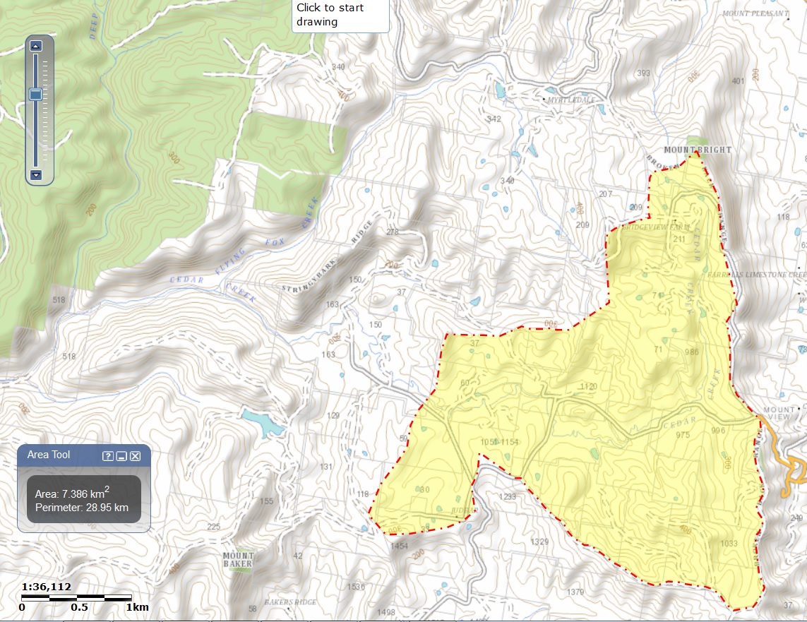
Within Cedars Mount View, the only access to proposed camp sites and stages is by fording Cedar Creek. Hundreds of vehicles fording a watercourse raise potential environmental hazards, or so it seems to me, yet the issue rates not a mention. Cedar Creek is the major watercourse through the site, though not the only one.

If I've used the NSW Government's Spatial Information Exchange tools right, the catchment down to and including Cedars totals more than seven square kilometres. Upstream of Cedars, where Mount View Road crosses Cedar Creek, the road is often flooded and badly damaged during storms. I certainly wouldn't want to be on the wrong side of Cedar Creek when there's a storm anywhere upstream in the catchment; particularly not with hundreds of other people. More particularly, not with hundreds of inexperienced city folk. It's worth noting that the residence used by proprietors of Cedars Mount View is on the Mitchells Road side of Cedar Creek.
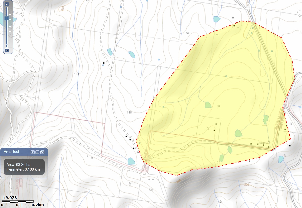
Between Mount View Road and the entrance to Cedars, Mitchells Road crosses a tributary of Cedar Creek. Again, if I've used the Spatial Information Exchange tools right, the catchment totals almost seventy hectares. Two 90-centimetre culverts carry that watercourse under Mitchells Road.

It's worth noting that, for the part of the catchment to its north-east, Mitchells Road itself serves as watercourse. Similarly, Mount View Road diverts down Mitchells Road, some runoff that would normally flow south.
It's not unknown to see storms dumping large amounts of rain in short periods of time in these parts, with very little warning. The Pasha Bulker storm comes to mind, but it's far from unique. Strangely enough, long term residents report that Mitchells Road sometimes gets a bit wet[0].
[0]Laconic Aussie understatement.
In the Statement of Environmental Effects, the only mention of a
watercourse I could find was of their "Chillout
Stage":
"Situated by the small creek under the canopy
of willows, it will be dimply lit with chandeliers in a wash of colors,
offering simple and comfortable furniture." The quote is
verbatim.
Those risks were classified as "low" and "ALAP" (to be kept "As low as reasonably practical").
I reckon, in the bottom of a mountain gully, I'd be most worried about flash flooding and being washed away and/or drowned.
Comically, the row immediately above was: "TV and Media". The identified risk was: "- Negative publicity". That risk was classified as "high" and "not acceptable".
So bad publicity is not acceptable but discomfort, injury or potential death of customers is to be kept as low as reasonably practical. Who'd be a customer?
Both documents were endorsed Commercial
In Confidence, so anybody wanting to see them will have to
approach Cessnock City Council. That said, in this context the validity of
the claim is legally questionable.
The risk management gave me so many chuckles that I had to trace the source. Is it any wonder that he wants it kept secret?
 This work by David Boxall is licensed under a Creative Commons Attribution-ShareAlike 3.0 Unported License |
Feedback: This e-mail address is being protected from spam bots, you need JavaScript enabled to view it. |